
There is one image of this object
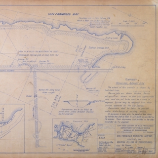
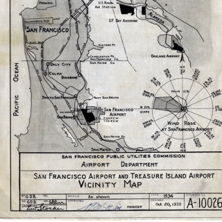
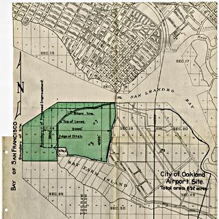
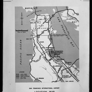
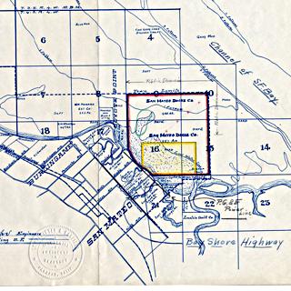
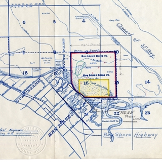
map: San Francisco Bay Area, airfields
| Date: | c. 1927 |
| Medium: | Paper, ink |
| Credit Line: | Collection of SFO Museum |
| Accession Number: | 2000.018.059 |
| Dimensions: | 12 1/4 x 9 1/4 inches (31.1 x 23.5 cm) |
| Collection: | Aviation Archive |
| Category: | Map / Chart |
| Subcategory: | Navigational |
| airport: | San Francisco Aerodrome , Oakland International Airport , Alameda Naval Air Station , Mills Field Municipal Airport of San Francisco |
| city: | Oakland |
| region: | California |
Similarobjects
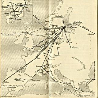
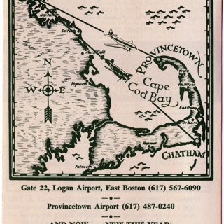
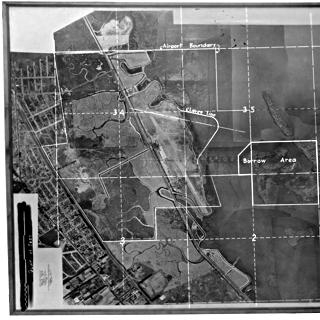
The following are SFO Museum Aviation Collection object images whose mathematical representations are similar to this image. These representations are referred to as vector embeddings and were derived using a series of different machine-learning models. The definition of similar
in the eyes of any given machine-learning model is often opaque, typically mysterious and sometimes incorrect. As such these objects are included because they are generally similar in nature, or spirit, and as a way to help you discover things in our collection which you might have otherwise missed.
The location
of this object is approximate and was derived from the 4 airports it has been associated associated with.
If you would like to embed this object in your own website click to expand
If you would like embed this object in to your own website copy and paste the following markup:
<div id="sfomuseum-image-1527819163" class="sfomuseum-image" style="max-width:640px; margin:auto 0;">
  <a href="https://collection.sfomuseum.org/objects/1511910163/"><img src="https://static.sfomuseum.org/media/152/781/916/3/1527819163_jKnCYWQ4ZisYaIjmN1vgY8TefkXM6bdX_z.jpg" alt="map: San Francisco Bay Area, airfields" /></a>
  <div id="sfomuseum-image-caption-1527819163" class="sfomuseum-image-caption" style="margin-top:1rem; font-style:italic;">
    <div><strong>Map: San Francisco Bay Area, airfields</strong> c. 1927</div>
    <div>Collection of SFO Museum</div>
    <div>Collection of SFO Museum <a href="https://collection.sfomuseum.org/objects/1511910163/">2000.018.059</a></div>
  </div>
</div>
If you would like to cite this object in Wikipedia click to expand
If you would like to cite this object in a Wikipedia article please use the following template:
{{cite web |url=https://collection.sfomuseum.org/objects/1511910163/ |title=map: San Francisco Bay Area, airfields |author=San Francisco International Airport Museum |accessdate=09 April 2026 |publisher=San Francisco International Airport Museum}}
Comments and Suggestions click to expand